Fountains!

I recently read a 1915 article about a late 12th century charter relating to Wardle (near Rochdale).  A local had donated a tenement to Fountains Abbey, it was even ratified by Richard I.

I wonder if land was donated to Fountains by other people in Rochdale Parish?

The record of land owned by Fountains was in five volumes, the fourth volume has not survived, but volume five (letters Q-W) has! it includes the Wardle charter and is in Rylands Library, Manchester (Latin MS 224).

Published in: on November 22, 2023 at 10:27 am  Leave a Comment  
Tags: , , , ,

Whitworth Hall

Medieval Spotland had many settlements and halls, for example Naden and Healey, I have not mentioned Whitworth Hall, until now. Below is a transcript of Charter 37 from from Volume III of the Coucher Book of Whalley Abbey, published by the Chetham Society:Whitworth_Hall_red

The site of the Old Hall was in the area of Hall Fold, see an aerial view here. The area is close to the river Spodden.

The 1851 OS map shows the location of Hall Fold.

1626 Manor Survey

HalFold1626ManSurv

Note the Fold had a “Corne Mill” a relic of the earlier Hall perhaps?


Digging Deeper with Stanford Online

Thanks to Stanford Online you can study this course:

“The Form and Function of Manuscripts introduces you to the way medieval manuscripts are interpreted, conserved, and disseminated today.”

Find out more here

———————————————————–

Schofield – the Place and the Name

I got a request for early references to the name “Schofield” so here is some information.

Schofield, in East Rochdale was in the township of Butterworth. Schofield was also adopted as a surname, let’s trace the roots of the Schofield family and the place back to Medieval times. As usual Fishwick’s History of Rochdale is a good place to start, it’s freely available online.  Fishwick covered the pedigree of the Schofield family name in the chapter on the Old Houses and Families of Butterworth.

Schofield Family

This information was deposited in the Duchy of Lancashire Court on 1537 as evidence of  James Scholfield’s claim to lands in “Wittaker”.

What does Schofield mean?

The modern study of Lancashire place-names started with Ekwall’s Placenames of Lancashire.  This is the most comprehensive survey, but it is not the latest work on Lancashire place-names and some of Ekwall’s work is disputed.

Ekwall on Schofield

“Scholefleld, or Schofield : de Scholfele 1212 LI, de Scolefeld 1374 LF, Scolfeld 1582 DL. O.N. skdli ” hut ” &nd field. “

So a “hut in a field” is the probable meaning., with the Old Norse word for hut being the first element in the name.

LI is an abbreviation for:

LI : Lancashire Inquests, Extents, and Feudal Aids. Ed. W. Farrer. Record Soc. xlviii, liv. 

Other Early References to Schofield

Both the Lancashire and Greater Manchester record offices also have documents of interest as does Touchstones in Rochdale.

Libraries

The black Book of Clayton (Bodleian Library) includes documents that mention “Schofield”. The Raines manuscripts have many references too.  Chethams and Rylands Libraries in Manchester also have original material relating to Schofield.

Manor Surveys

The 17 thC. Manor Surveys have many references to the place and the people names Schofield. The manor court records also should be checked for Schofield references.

Online

You can also search the British History Online site, and of course the National Archives, which include the British Library Collection. The Coucher Book of Whalley Abbey has references to Schofield, start with the index.

Later Entry from Coucher Book of Whalley Abbey

Here is an example from the Appendix of the Coucher Book of Whalley Abbey, perhaps early 16th. C

SchofieldWC1231


Schofield Hall

SchofieldhallRaines266


The site of the Hall has some field boundaries but little trace of the hall remains. The Old Hall was depicted in the Raines Manuscripts. There were many of these old halls, Fishwick’s History has some illustrations.

Under construction…


Published in: on June 27, 2014 at 9:32 am  Comments (4)  
Tags: , , , ,

Chadwick Family Charters Aquired by the British Library in 1913

There are a total of 634 charters (British Library Catalogue 57624-58263) that belonged to the Chadwick family and are now in the British Library, 100 of these charters relate to places in Salford Hundred.

Salford Hundred

One Manchester Charter from 1744
Charter 57629.

6 Radcliffe charters from 1300-1511
Charters 57630, 57631, 57633, 57678, 57679, 57681.

93 Rochdale charters from 1295-1703.
Including Blatchinworth, Buersill, Castleton, Healey, Hundersfield, Spotland, Wardle, etc.
Charters 57632-57724.

Search the British Library manuscript catalogue here.

Published in: on April 4, 2014 at 10:48 am  Leave a Comment  
Tags: , , , , ,

Two of Prickshaw’s Medieval Charters

There are many medieval references to places that are in or around the area known today as Prickshaw.

Here are two charter transcripts from the Coucher Book of Whalley Abbey,
originally published by the Chetham Society.

Image

In this charter we can see “Prikkeshaghsiche”
it would now be written Prickshaw Syke.

Image

Note

Lake Kor was probably the area now known as Prickshaw Dams.

Charter LXI

Image

Charter LXI Continued…

Image

Appendix – Bagden, Prickshaw 

Coucher Book Appendix
Appendix in Coucher Book

Reference

Originally printed for the Chetham Society 1848 by William Adam Hulton.

NOT  IN  COPYRIGHT

Download The Coucher Book of Whalley Abbey Here.

Balshaw Mystery

There are literally hundreds of medieval references to places in Rochdale, most places can still be traced, a few have disappeared from the map. But most interesting of the vanished places is Balshaw, and the people who lived there in medieval times.

Why?

In the Coucher Book Balshaw is written as Balschagh and appears to have been near to Healey Hollows by a brook or Brok (as it was written in the charter).

Image

In charer 68 one of the signatories, Adam, appears to have lived in Balschagh and is referred to as Ada de Balschagh.

Image

The Bedelry

In 1281 Adam de Balshaw purchased the serjeancy of the “free court of Rochdale” in exchange for land in Rossendale and ‘Holkenheved,’ at a rent of 2 marks a year; Byron Chartul. (Towneley MS.), 1/248.

If this was the same Adam that witnessed Coucher Book charter 68, where did he get his wealth from? Why did he have land in Rossendale? and where exactly did he live, and what was his reason for buying the serjeancy (which means it was originally a gift from the King)?

See British History Online – The Parish of Rochdale fn 40

“In 1298, the ‘heir of Adam de Balshaw’ paid 26s. 8d. for the bedelry; Compotus, 7; and in 1311 the holder was a John de Balshaw;”

De Lacy Inq. 20

De Lacy 1311 John de Bal...

Ultimately the serjeancy was sold to members of the Radcliffe family by a John de Balshaw in 1341, perhaps the same John mentioned in 1311.

See British History Online – The Parish of Rochdale fn 40

The special legal status of Rochdale is evident from the Domesday entry for Rochdale and the “free court of Rochdale” presumably evolved  from this.

Where?

The name Ball Barn on Syke Road in Rochdale may preserve elements of the old Balshaw name, it is in the area mentioned in the charters.

Not to be confused with…

By coincidence there is another Balshaw in Ainsworth, and in a land grant by Roger de Middleton, about 1200 there is mention of a “syke” that led to Ballshaw. syke was a common local dialect word(from Old Norse) for a ditch.

The grant is included in the Cockersand Chartul. (Chet. Soc), ii, 733.

Under construction….

What have a world famous poet, a teenage computer pioneer, medieval charters and Whitworth got in common?

No Joke! in 1833 the Coucher Book of Whalley Abbey was of great importance to a teenage computer pioneer, the daughter of the famous poet.

She joined others in a case against the Lord of the Manor of Rochdale, over land rights in Brandwood, West Whitworth.

The former Lord of the Manor was Lord Byron, the poet, his daughter Ada (Countess pf Lovelace) was a brilliant mathematician and programmer of Babbage’s Inference Engine. Ada still had an interest in lands in Brandwood after Dearden had aquired the manor of Rochdale from her father, Lord Byron.

The claim was that land in Brandwood had been enclosed and that this was included in the Manor of Rochdale, The case was judged in favour of the defendants, since they used the Coucher Book of Whalley’s records to show that rights had been granted to their ancestors in medieval times, well before the manor was sold to Lord Byron’s ancestors. So it Brandwood was judged to be outside of the manor of Rochdale’s jurisdiction.

Read more about this fascinating case here from  page 80 onwards. Archive material is also held at Touchstones in Rochdale.

See also

Ada Lovelace (Wikipedia entry)

Reports of cases argued and determined in the Court of King’s Bench, Volume 1

By Sandford Nevile, William Montagu Manning (Sir.), Sir William Montagu Manning, Great Britain. Court of King’s Bench, London 1834.

Under construction!

Medieval References to Boundaries and other Landscape Features

The most famous  medieval boundary in the region is the Nico Ditch, but there are many other medieval references to boundaries, usually ditches. There were many references to natuaral boundaries too, such as rivers and streams.

Ditches

The Nico Ditch was mentioned in the 12th C. it is the longest recorded ditch in the region. Read more about the Nico Ditch here.

Ditches mentioned in the Coucher Book of Whalley

There are many references to man made boundaries in the Coucher Book of Whalley Abbey, here are some examples.

Rochdale castle ditch

Rochdale’s castle was in a commanding position overlooking the confluence of the Roche and Spodden rivers, and the route to Manchester. The charter transcribed in medieval Latin and published well over a hundred years ago, is from volume 2 of the Coucher Book of Whalley Abbey. The charter refers to “Merlond,” modern Marland, and Castleton. The castle ditch in Latin is “fossatum castelli” in the extract below.

castle ditch reference

Rochdale castle – the castle ditch

TBC

Parish Boundaries

Parish surveys usually started by defining the features used to delimit the parish. These could be streams, ditches or lanes, for example. These features were  still used in the post medieval period, in this survey of Rochdale from 1610, summarised here, you can still read the names of features first mentioned in medieval charters and other documents.

Boundary Stones or “Meres”

Large stones were often used as boundary markers between townships or parishes, such as open heaths or moorland.

Here is a 16th Century reference to the size of stones used to mark the boundary of Rochdale and Oldham, near Buersill.

“Sir John Byron caused “divers great stones, every stone as
much as twenty oxen could draw,” to be set up much within the
boundary line of Hathershaw moor, and if not removed will soon be
taken to be the “meres” rightly set up between the two wastes . Sir
John Byrori s reply to this was to the effect that he was seised as of
fee of his “own severall enherytance” in Buersill moor, which was
divided from Hathershaw by certain “meyers” which by the informers or
other “evilly disposed persons” have been removed, and to remedy this
he had obtained the writ as set forth by the plaintiffs, and by virtue of
it Sir John Atherton caused “certain honest persons” to make the
perambulation and set the ” meyers ” in such places as they had always
been ; since then he had caused to be placed on his own lands certain
stones that the boundaries might be the better known.”

Fishwick description of a 1552 Duchy of Lancaster Court case from the History of the Parish of Rochdale – Castleton Township.

Natural Boundaries

Rivers were often used as boundaries, the river Mersey means boundary river. Prominent rocks or large stones were used as well, the “Wolf  Stone” in Naden near Rochdale, for example.

Rivers

Rivers were often used as boundaries and are amongst some of the earliest places mentioned in medieval documentation of the region. The name Mersey, as in the river Mersey means boundary river, according to Ekwall and other place-name experts.

Fords

A ford over the river Roche was  called “Irreford” in medieval times. This led Ekwall to wonder if the Roche was originally called “Irre” similar name  to the nearby  Irwell and Irk rivers.

Lakes

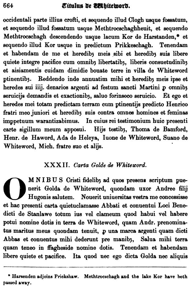
Lakes were an important source of fish as well as being a natural landmark. Marland in Rochdale was owned by Whalley Abbey, while Lake Kor near Prickshaw in Whitworth was mentioned in a medieval charter in the Coucher Book of Whalley Abbey. Sadly both lakes have gone, the former was in what is now Marland Park, the latter may be where the ponds east of Prickshaw are now.

Ashworth – an example of medieval boundaries and disputes.

Ashworth was a township of the Parish of Middleton, due to the detached portions (parish districts. distant from, but not connected to the main parish) of Middleton Parish boundaries were complex, perhaps some of the most complex in England. There are detached portions that

There are many references to boundaries and boundary disputes in Ashworth, several are mentioned in the footnotes of the Chapter here.

Note

There is a 1287 reference to ‘syke,’ a dialect word for an artificial ditch usually dug as a boundary, see footnote 11 here.

There was also a well documented dispute in the 16th C. also documented in the Ashworth Township chapter.

Under construction…

Digital Diplomatics

Digital diplomatics uses computer technology to study documents, for example digital techniques can be used to enhance faded medieval documents or to analyse the content of translated documents.

Conference

A conference will be held later this year to present the latest research in digital diplomatics, you can read more here Digital Diplomatics Conference.

Further study

It would be great to see research like this for documents from Salford Hundred.

More about digital diplomatics can be found here .

Digitized medieval manuscripts interoperability conference papers can be  found here.

Under construction…